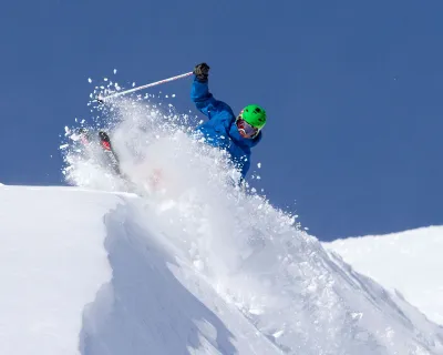
Snow forecast 2024-25: science, lore and tips for storm tracking
Science, history, lore… from 200 years of historical archives to cutting edge meteorology, we crave that sweet, sweet snow intel: what's the snow going to be like this season? Where and when is it going to snow the most? And can we hope for powder days near us?
So much is up in the air, literally: La Niña, El Niño. Climate change. Polar vortexes. Micro-climates. The long-term snow forecast is affected by many different factors.
Our Western Canada snow forecast for 2024-25 dives into insights from the Farmers' Almanac, the National Oceanic and Atmospheric Administration and Environment Canada weather modeling, interpreted by SnowSeekers' resident weather expert Kyle Brittain, to shed some light on the season ahead for BC and Alberta.
Big picture: Farmers' Almanac winter forecast 2024-25
Think of the almanac as a macro-view. In broad strokes, it touches on what may happen over an entire season.

For Canada, the Farmers' Almanac forecast is calling for a "wet winter whirlwind" of a season. But what does that mean?
A snowier winter for BC
"Wet" is the actual description but at colder temperatures, that precipitation is likely to fall as snow, according to the almanac.
A colder winter east of BC
For Alberta, being on the eastern slopes of the Canadian Rockies means we will see colder temperatures and that should mean snow consistency, with possibly higher volumes of snow spilling over from BC.
Storm potentials
- Jan 20-23
- Jan 24-27
The almanac flags these dates primarily for regions east of the Great Divide, but it's likely large storm fronts will be common during this period across Canada.
Most skiers and snowboarders in Western Canada know the period from late January to early February has a history of being cold and snowy, with February and March being some of the best skiing as a result.
The Farmers' Almanac is famous for having a proprietary weather forecasting formula built on 200-plus years of weather data, and an 80% track record for accuracy. But does the science back it up?
That's where we bring in calculations for ENSO and Environment Canada weather modeling, via our weather expert Kyle Brittain.
ENSO: El Niño, La Niña and snow in Western Canada
ENSO is becoming famously known as an influence on the Alberta and BC snow season. Any long term forecast has to take ENSO into account.
While you may have heard these terms before, how many of us know what they actually mean? Even for those who do, a quick refresher doesn't hurt to help wrap our heads around the phenomenon.
ENSO: the El Niño-Southern Oscillation, a cyclical pattern of sea surface temperatures in the central and eastern tropical Pacific Ocean that influence weather and precipitation globally
El Niño: the warmer and drier half of the cycle, usually bringing lower than average snow seasons across much of Canada
La Niña: the cooler half, which tends to bring colder and snowier than average conditions to the mountains of western Canada
This winter, according to SnowSeekers weather expert Kyle Brittain, the El Niño pattern from 2023-24 has faded, and La Niña is expected to make a (weak) comeback. Which should mean good news for snow lovers.
Brittain explains: "La Niña conditions typically mean colder and snowier than average conditions across the mountains of western Canada, which increases our confidence, especially when combined with long-range models, which are generally saying the same for this winter.
"However," he cautions, "no two La Niña events are the same, and sometimes winters can be different than expected."
Geography and the jet stream
While storm fronts often flow westward (often with a southerly or northerly slant) from the Pacific, this is not always the case. Geography plays a part here.

Imagine the Canadian Rockies like a curtain dividing a room. Sometimes the air passes freely around and through the curtain. Sometimes the curtain acts as a barrier, separating the flow of air and precipitation.
Kyle Brittain explains: "We frequently see a clash of air masses from different origins (ie Pacific, Arctic, etc). The jet stream exists at this boundary between air masses and storm systems typically travel along this track, bringing us precipitation and windy conditions at times.
In Alberta, east of the Rockies, shallow arctic air masses in winter are free to flow down across the province, whereas the Rockies and other mountain chains act as barriers to this air, meaning it is typically warmer the further west into BC you go."
stoke, fresh tracks & après hacks
get the 2-minute weekly winter newsletter relied on
by thousands of skiers and riders in Western Canada
Meaning, in effect, sometimes the pineapple express will pass from BC into Alberta, and sometimes it won't. And sometimes BC will dodge the passage of a particularly nasty Arctic front that sweeps down the eastern front ranges into Alberta, the prairies and points east.
Long range weather modelling
Predicting jet stream behaviour is one challenge. Another is forecasting precipitation.
"Precipitation is typically the most challenging weather variable for weather models to predict even within 24 to 48 hours at times," says Brittain.
As soon as you add elements such as complex, mountainous terrain, where precipitation totals are highly variable, it becomes challenging once again."
Despite these complex variables, Brittain has reasonable confidence when he predicts: "Overall, one would expect cooler conditions than normal, with wetter than normal conditions across the mountains of western Canada."
Storm tracking for powder days
Beyond that, he advises checking snow reports regularly. editor's note: we wholeheartedly concur!

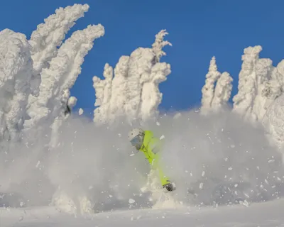
Photo:
Marty Clemens
"I start getting excited about forecast heavy snow within about 2-3 days of an event, but I've had my heart broken many times when the forecast precipitation suddenly dropped out of the models or moved out of the area, occurring somewhere else.
Conversely, we've also seen surprisingly heavy events occur in certain cases that were either poorly modeled, or just showed up last minute. Looking at social media, webcams, and weather stations can help give a sense of what's going on out there.
You generally have to keep on top of things with precipitation, checking regularly (ie daily or more)."
Shameless plug: during the season, our Snow Conditions is a great tool to monitor snowfall, updated hourly. From there, you can click on any resort to go even deeper to get the complete snow conditions, weather forecast and operating information for the resort you're interested in.
The takeaway: what will 2024-25 ski season bring?
All the models tend to agree: this year will be a better snow year than 2023-24.
How much better remains to be seen.
Key takeaway for BC: more snow is expected, so if you're local or planning trips, watch that forecast and check our snow conditions.
Key Alberta takeaway: at least as much snow, if not more, is likely, and with cooler temperatures through this winter it is likely to be a more stable season with better snowpack.
In the end, of course, how the ski season turns out largely depends on you and what you make of it, regardless of conditions. Starting now.
Make the best of 2024-25 ski season
Spend your winter doing more of what you love: skiing and riding!
Here are three things you can do now:
- enter to win lift tix
- sign up for the SnowSeekers newsletter
- and grab some of the tips below to get your stoke on and start preparing now